

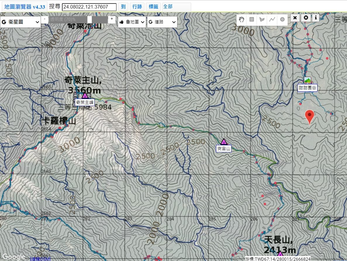
今年來疫情的關係很多人登山爬山,只不過大部分都沒有帶紙本地圖,有可能是懶惰圖方便,也有可能是不懂得使用,個人也在此寫這篇介紹文來跟大家介紹一下如何使用製造紙本地圖。
Due to the pandemic this year, many people have taken up hiking and mountaineering. However, most of them did not bring paper maps with them, either out of convenience or because they do not know how to use them. Therefore, I am writing this introductory article to explain how to create and use paper maps.
紙本地圖百百種,當中最知名的就是上河文化地圖,只不過要價不菲,一般人也不捨得在地圖上畫新資訊,因此,地圖產生器(Happyman) 變成了在台灣CP值最高且容易匯出資料的非常好用的工具。
There are many types of paper maps, but the most well-known one is the Sunriver Paper Map, which comes with a hefty price tag. Most people are reluctant to add new information to the map. Therefore, the map generator tool – Happyman (地圖產生器) has become the most cost-effective and user-friendly tool for creating maps and exporting data in Taiwan.
現在,就讓我來跟大家介紹,如何使用地圖產生器(Happyman)產生並匯出紙本地圖。
Now, let me introduce to you how to use the Happyman (地圖產生器) to create and export paper maps.
| 【工商服務一下,閲讀以下之前,想邀請大家訂閲及追蹤,給予我鼓勵,謝啦!】 【Before start to read, welcome to follow and subscribe my platform as an encouragement for me, thanks! 】 ✔ 點擊追蹤(Click to follow) 法蘭怎麽玩(How Frank Play) Instagram ✔ 點擊追蹤(Click to follow) 法蘭怎麽玩(How Frank Play) Facebook ✔ 點擊訂閲(Click to subscribe) 法蘭怎麽玩(How Frank Play) Youtube Channel |
Contents
- 01 認識坐標單位 What’s the long. & lat. coordination
- 02 認識地圖格式 Introduction of the map format
- 03 網站其他介紹 Other features intro
- 04 產生地圖的使用步驟 Steps to generate a happyman map
- 04-1 搜尋/打開地圖產生器 Search/Open Happyman Map
- 04-2 輸入山名或坐標 Key in the mountain name or coordinate
- 04-3 點選要去的行跡以選擇行跡兩次 Click the target blue GPX twice for choosing the wanted GPX
- 04-4 選擇範圍 Choose the area that want to generate
- 04-5 產生地圖 Generate the map
- 04-6 勾選地圖上所需資訊后確認按輸出 Check the required information on the map, confirm and generate
- 04-7 地圖產生中需稍後 Map generation will take a while
- 04-8 地圖產生后即可下載 Files type download are available after generated
- 04-9 地圖列印及防水 Map printing and waterproofing
- 05 輸出KMZ用於谷歌地球 Use KMZ in Google Earth
- 06 總結
01 認識坐標單位 What’s the long. & lat. coordination
在那之前,先介紹認識一下坐標。最後選擇哪個座標都需要清楚,以免需要救援時報錯格式的坐標,會影響搜救時間,座標差距10m以上都影響很大。
Before that, let me introduce you to the concept of coordinates. It is important to be clear about the coordinates you choose, to avoid reporting incorrect coordinates in case of rescue operations, as a difference of more than 10 meters can greatly affect the search and rescue time.
地圖產生器僅有 TWD67 和TWD97,就是下方會介紹的2和3。
The map generator only has TWD67 and TWD97 coordinates, which are the ones I will introduce in points 2 and 3 below.
01-1 經緯度 TWD97/WGS84 (Longitude/Latitude TWD97/WGS84)
TWD97 與 WGS84 兩者相差不大, 大約幾公分至數十公分, 一般在登山及導航的應用時,可以視為一致,詳細請參考:Taiwan datums – OSGeo ,一般就是谷歌地圖所使用的那種。
TWD97 and WGS84 are not very different, with a difference of a few centimeters to tens of centimeters. In general, they can be considered the same in applications such as hiking and navigation. For more information, please refer to “Taiwan datums – OSGeo,” which is the same as the one used by Google Maps.
01-2 二度分帶 TWD67 TM2 (Transverse Mercator Projection TWD67 TM2)
二度分帶 TWD67 是內政部公告之坐標基準係引用國際上的 Geodetic Reference System 1967 的橢球體大小, 作為臺灣地區大地基準的橢球大小, 其坐標基準在埔里,詳細請參考:Taiwan datums – OSGeo
TWD67 TM2 is a coordinate reference system announced by the Ministry of the Interior. It uses the size of the Geodetic Reference System 1967 ellipsoid as the size of the ellipsoid for the geodetic reference in Taiwan. The coordinate reference is based in Puli. For more information, please refer to “Taiwan datums – OSGeo.”
01-3 二度分帶 TWD97 TM2 (Transverse Mercator Projection TWD97 TM2)
二度分帶 TWD97 名字中的 ’97’ 是因為臺灣地區於 1997 年以 GPS 重新計算坐標基準, 於 1997 年完成, 他的橢球體大小是採用國際上的 Geodetic Reference System 1980 的橢球體大小, 此橢球大小與 WGS84 的球體大小兩者可說相同,詳細請參考:Taiwan datums – OSGeo
TWD97 TM2 is named “97” because the coordinate reference system was recalculated using GPS in 1997. The ellipsoid size used was the Geodetic Reference System 1980, which is the same as the size of the WGS84 ellipsoid. For more information, please refer to “Taiwan datums – OSGeo.”
02 認識地圖格式 Introduction of the map format
地圖產生器可以選擇大地基準和圖層,提供經建一、經建三和魯地圖。經建跟魯地圖在有些圖資表現方式不一樣,經建一跟三差在等高線測量的年代,而魯地圖則是現在一直都不斷更新等高線,一般都會選擇魯地圖。
The map generator can choose geodetic datum and layers, and provide Jingjian 1, Jingjian 3 and Lu maps. Jingjian and Lu maps have different presentation methods in some maps. Jingjian 1 and Jingjian 3 were measured in contour lines, while Lu maps are constantly updating contour lines, and Lu maps are generally selected.
02-1 地圖格式(魯地圖、經建三)Map format (Lu map, Jingjian 3)
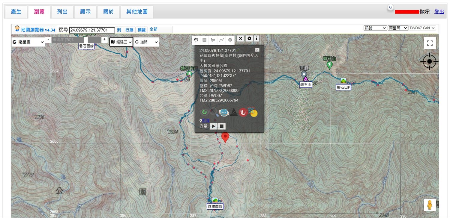
經建三:橋、電塔、建築物等標示的話,看經建三會比較好一點,水線比魯地圖保守不少,會短很多,旱季的時間需要確認水線可以參考經建三。
Jingjian 3: Bridges, towers, buildings, etc., it is better to look at Jingjian 3. The waterline is much more conservative than Lu map, and it will be much shorter. If you need to confirm the waterline in the dry season, you can refer to Jingjian 3.
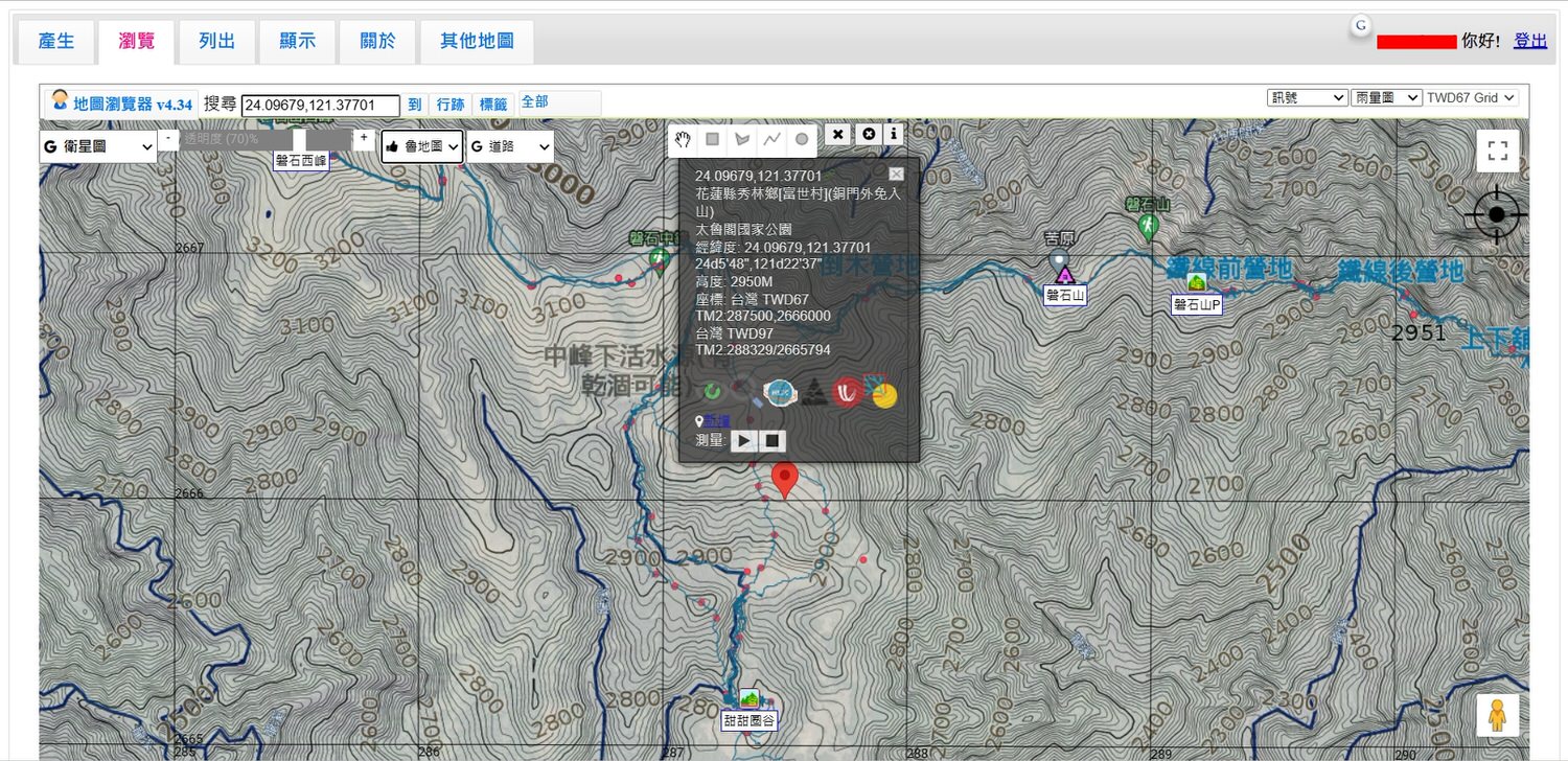
魯地圖:魯地圖在等高線會比較接近現況,地圖上顯示的數字高度也比較多和比較好找,水線比經建三長很多,基本上都還是可信,只不過若是一直都沒下雨就要想清楚了。文字標記也比經建多,這樣可以直接知道那裏是哪裡,缺點就是因為這些標記是收集網友的標記集合而成,有可能會誤標或亂標。
Lu map: The Lu map will be closer to the current situation in terms of contour lines. The number of heights displayed on the map is also more and easier to find. The waterline is much longer than Jingjian 3. Basically, it is still reliable, but if it has not rained all the time still have to figure it out. There are also more text marks than Jingjian, can directly know where it is. The disadvantage is that because these marks are collected from netizens, there may be mistakes or random marks.
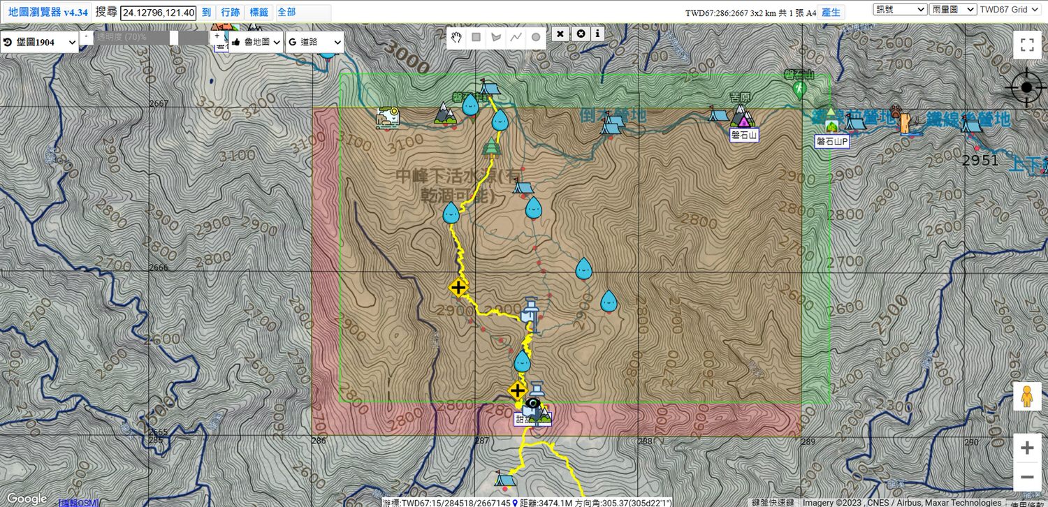
圈選格數介紹:一張A4印出來會包含5*7格,一張A3印出來會包含7*10格。格數沒算好有可能會出現印出來一整頁就只有一點點的情況(例:5*8格就會有兩張A4),會自動以最省紙的方式輸出直式或橫式。
Introduction to the number of circled grids: A printed A4 sheet will contain 5*7 grids, and an A3 printed sheet will contain 7*10 grids. If the number of grids is not calculated properly, there may be a situation where only a little bit is printed on a whole page (for example: 5*8 grids will have two A4 sheets), and the vertical or horizontal format will be automatically output in the most paper-saving way.
02-2 行跡&標簽 Gps & Label

網頁地圖上方中間偏左有「行跡」「標籤」「全部」3個按鈕。
There are three buttons on the upper middle left of the web map: “Trace”, “Label” and “All”.
行跡:地圖產生器會抓山友們上傳到網路上的行跡,行跡是藍色的線,越粗的線代表越多人走過,據説很少人走的探勘路線會被顯示,以免誤闖迷路,點一下行跡便可以選擇顯示或不顯示。
Gps: The map generator will capture the whereabouts uploaded by mountain friends on the Internet. The whereabouts are blue lines. The thicker the line, the more people have walked by. If you get lost, you can choose to display or not display the track by clicking it.
標籤:顯示各山名、三角點、溫泉、駐在所等等,點一下便可以選擇顯示或不顯示。
Labels: Display the names of mountains, triangle points, hot springs, residences, etc., can choose to display or not display them with one click.
全部:可以選擇要在標籤顯示哪些地方,基本有一二三等三角點、森林、百岳、小百岳、溫泉等可以選,點一下便可以選擇顯示或不顯示。
All: Can choose which places to display on the label. Basically, there are one, two, three, etc. triangle points, forests, Baiyue (100 peaks), Xiaobaiyue (Small 100 peaks), hot springs, etc. to choose from, can choose to display or not display them with one click.
03 網站其他介紹 Other features intro
跟大家介紹一下網站其他功能。
Let me introduce the other features of the website.
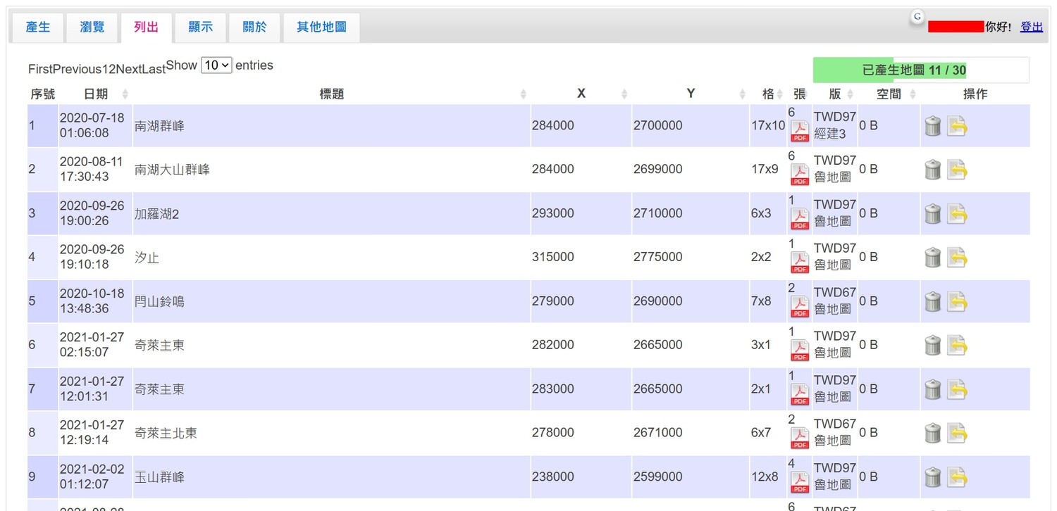
03-1 左上方的列出 Upper left list out
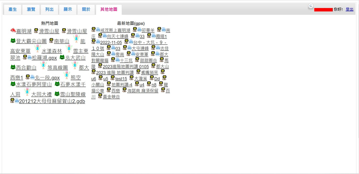
03-2 左上方其他地圖 Upper left other map
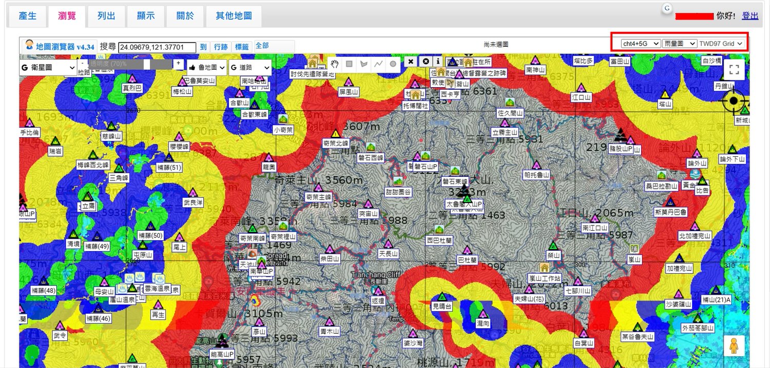
03-3 電信訊號 Telecommunication signal
03-4 其他圖資 Others map info
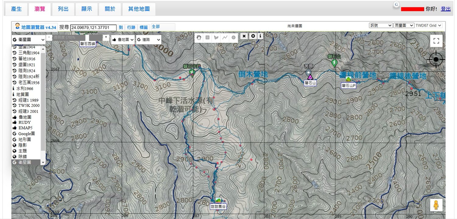
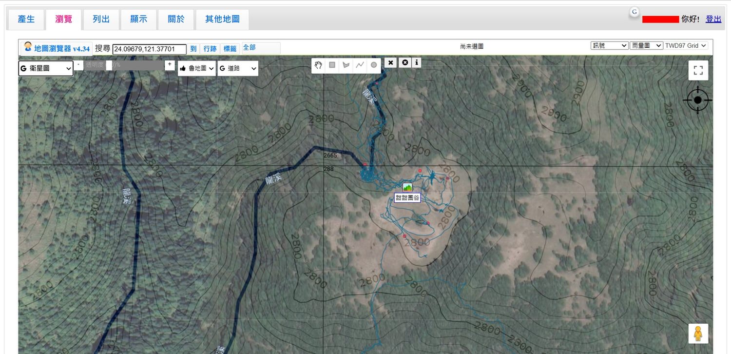
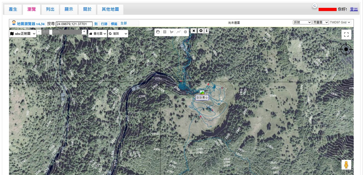
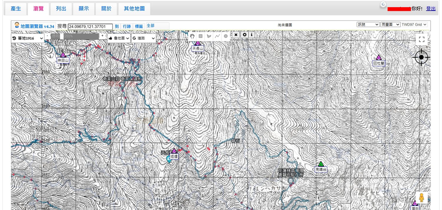
衛星圖、nlsc正射圖、日據時期的蕃地圖。nlsc正射圖乃國家測量單位可以公佈的新圖資,有地貌+等高線,等高線比魯地圖還準。日據時期的蕃地圖,找駐在所或遺跡古道的優良參考資料。
Satellite images, nlsc orthophotos, and Fan maps during the Japanese occupation period. The nlsc orthophoto map is a new map that can be published by the national surveying unit. It has landforms + contour lines, and the contour lines are more accurate than the Lu map. Maps of the Japanese during the Japanese occupation period, excellent reference materials for finding residences or relics and ancient roads.
04 產生地圖的使用步驟 Steps to generate a happyman map
在此會介紹從搜尋,到產生和輸出的步驟介紹。
The steps from search to generation and output will be introduced here.
04-1 搜尋/打開地圖產生器 Search/Open Happyman Map
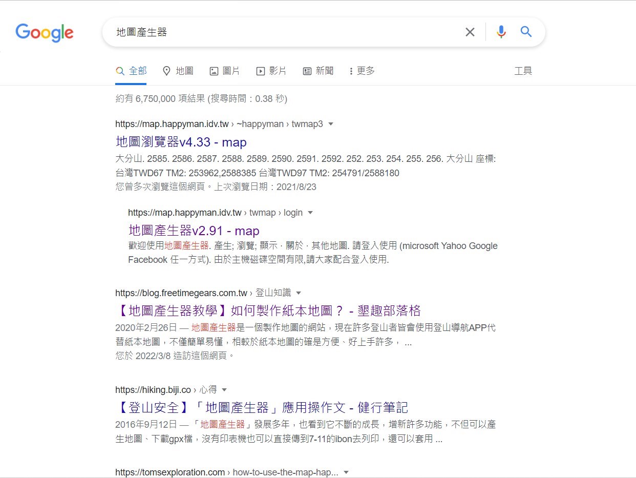
→ 點選:地圖瀏覽器 v4.33 (happyman.idv.tw)
→ Click: 地圖瀏覽器 v4.33 (happyman.idv.tw)
→ 選擇登入賬號(可以考慮使用谷歌郵件,請一定要登入)
→ Choose the login account (Gmail recommended, login is must to do)
04-2 輸入山名或坐標 Key in the mountain name or coordinate
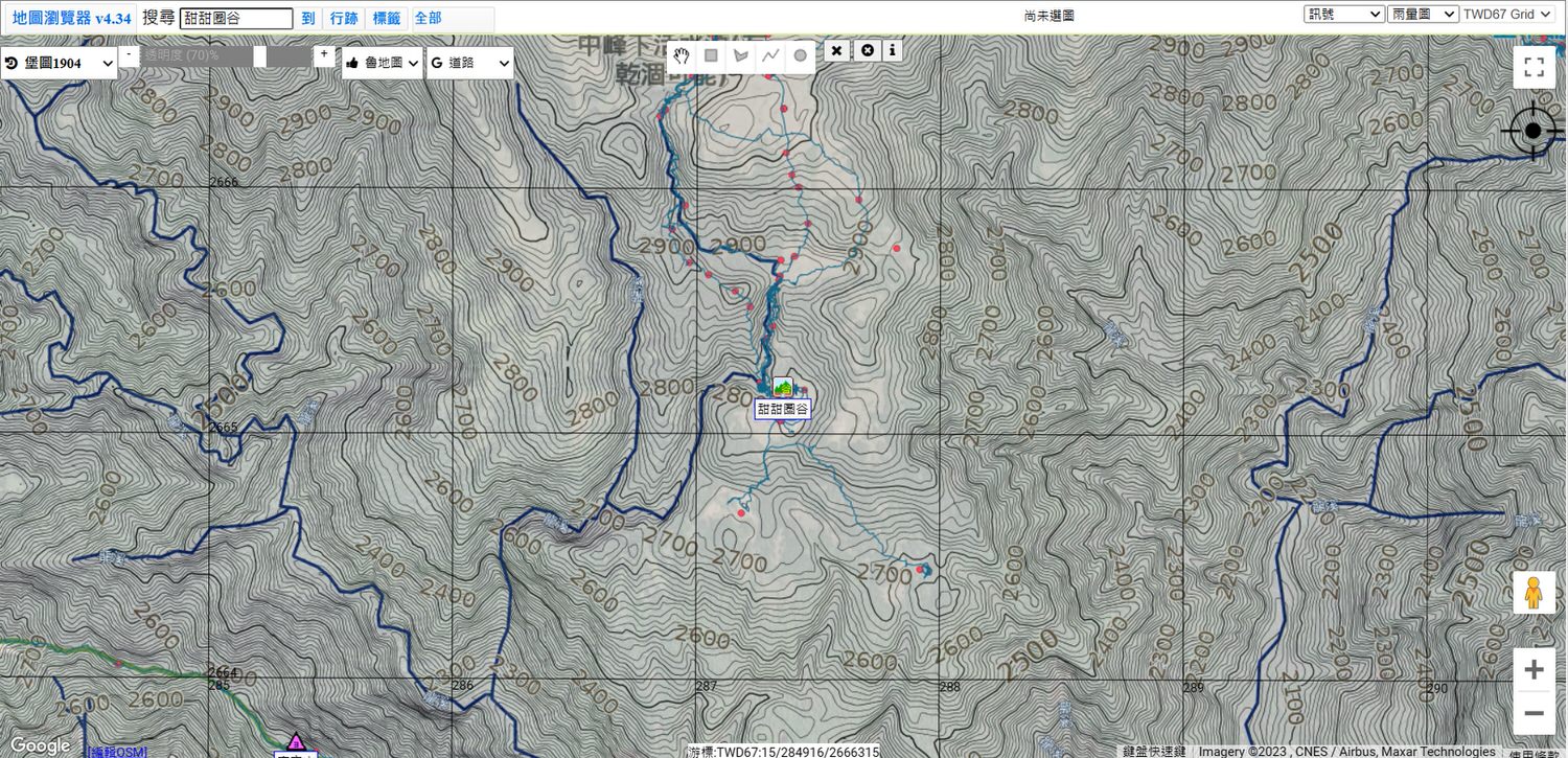
可以依照自己的需求放大縮小需要的範圍來看。
You can zoom in or out according to your needs.
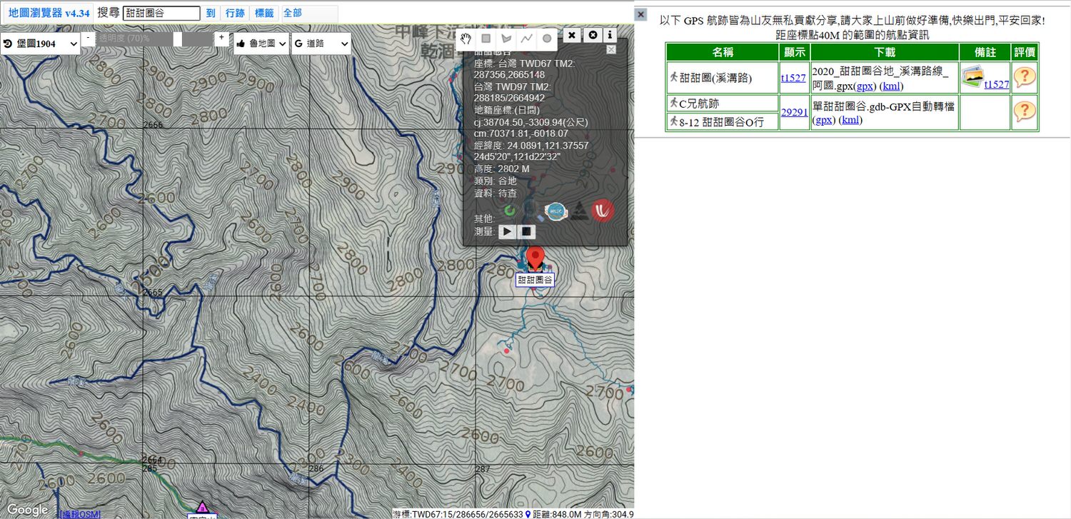
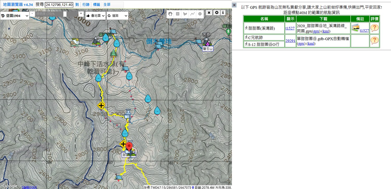
04-3 點選要去的行跡以選擇行跡兩次 Click the target blue GPX twice for choosing the wanted GPX
04-4 選擇範圍 Choose the area that want to generate
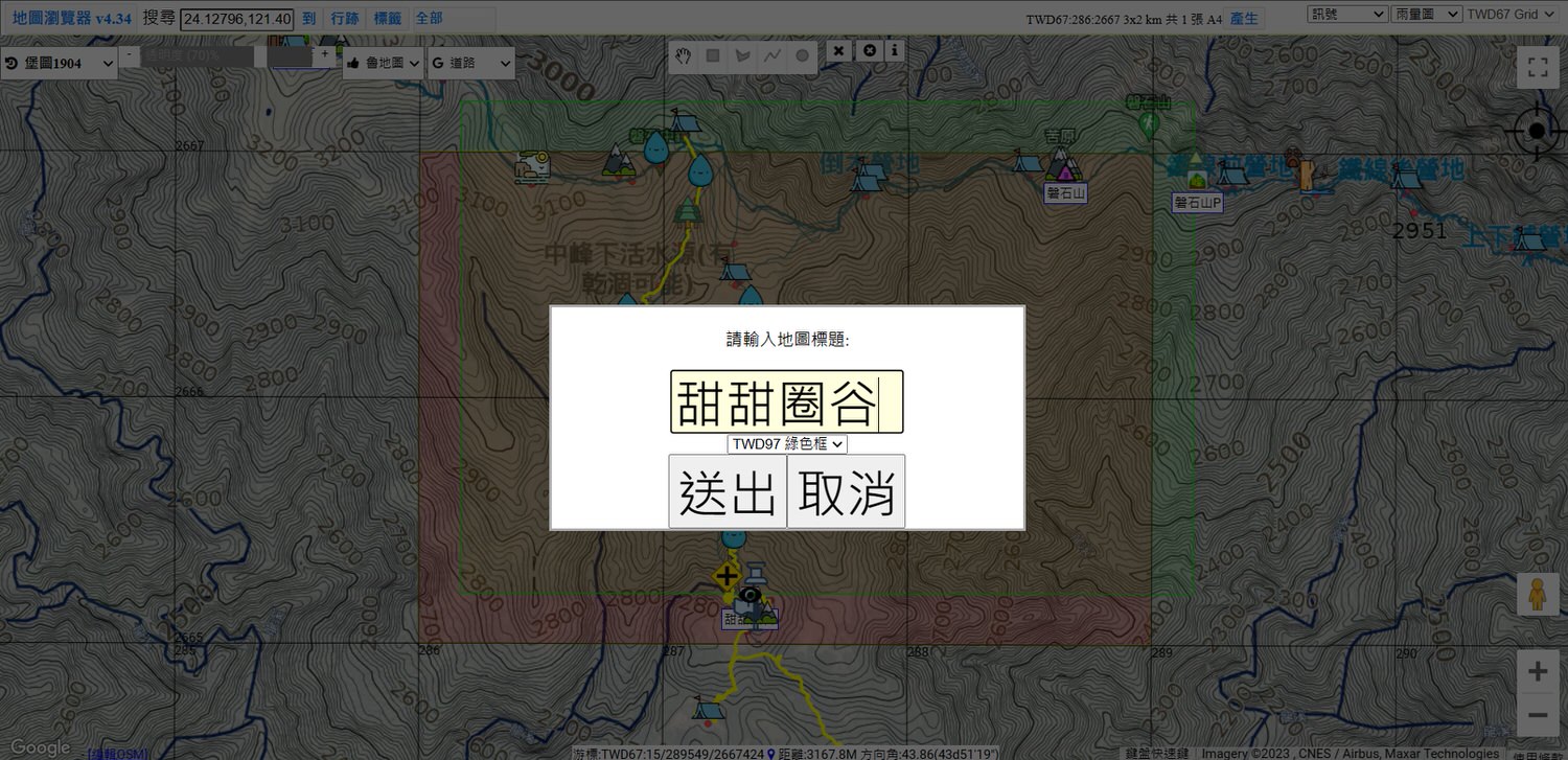
04-5 產生地圖 Generate the map
04-6 勾選地圖上所需資訊后確認按輸出 Check the required information on the map, confirm and generate
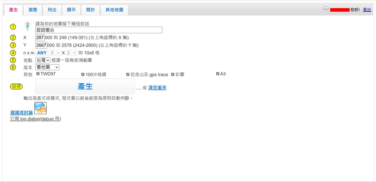
- TWD97:上面的座標介紹有説明
TWD97:The above coordinate introduction has a descriptions. - 100米格線:把原本的格線切成10*10=100格(原本一格1公里,切成一格100m)
100-meter grid line: cut the original grid line into 10*10=100 grids (the original grid is 1 km, cut into a grid of 100m). - 包含山友gps trace:山友航跡圖(藍色的線),建議選一下
Contains the hikers gps trace: The other hikers track map (blue line), it is recommended to choose. - 彩圖:列印彩圖會比較明顯尤其是水線,列印品質就看輸出機器了
Color image: Printing color images will be more obvious, especially the waterline. The printing quality depends on the printer. - A3:列印檔案會變成A3,會建議選A3,不然輸出會變A4檔案,A4張數多需要自己拼黏,不好黏還可能增加誤差
A3: The printing file will be A3 format. It is recommended to choose A3, otherwise the output will become A4 file. If there are too many A4 sheets, you need to glue them together, more sheets will may increase the error.
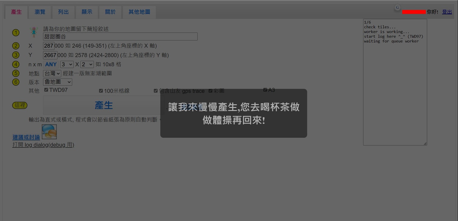
04-7 地圖產生中需稍後 Map generation will take a while
04-8 地圖產生后即可下載 Files type download are available after generated
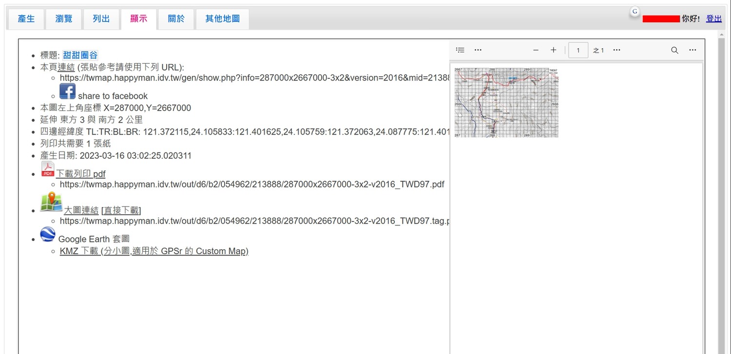
04-9 地圖列印及防水 Map printing and waterproofing
當地圖列印后,需要進行裁剪和拼貼,可以使用膠水或雙面膠(或放進去地圖袋)用以防水。選擇 PDF 列印會是最方便的方式,而KMZ 則可以下載并輸入至手機離線地圖使用.
After printing the map, cut and paste it, and then seal with the glue or double side tape (or put it in the map bag) to make it waterproof. It is the most convenient way to choose PDF printing, while KMZ can be downloaded and imported to the mobile phone for offline map use.
05 輸出KMZ用於谷歌地球 Use KMZ in Google Earth
使用地圖產生器製作地圖的時,KMZ的檔案可以有不一樣的用途,KMZ檔案可以匯入到谷歌地球或是手機裡的離線地圖,匯入到手機裡的離線地圖在下次介紹手機APPS的時候再説,這次要説的是可以其中一個選項是 Google Earth,檔案輸出成KMZ檔,我們使用 Google Earth 網頁版或是電腦版使用都可。
When using the map generator to make a map, the KMZ file can have different uses. The KMZ file can be imported into Google Earth or the offline map in the mobile phone. The offline map imported into the mobile phone will be introduced next time when i write about the mobile APPS. Besides, what I want to say this time is that one of the options is Google Earth, and the file is output as a KMZ file. We can use Google Earth web version or computer version.
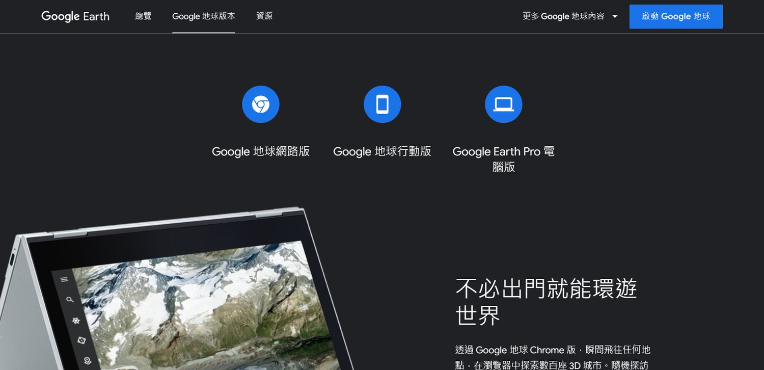
搜尋到谷歌地球進入的頁面後就有網絡版、行動版和電腦版可以使用。
After searching the page entered by Google Earth, there are web version, mobile version and computer version available.
05-1 谷歌地球網頁版 Google Earth Web Version
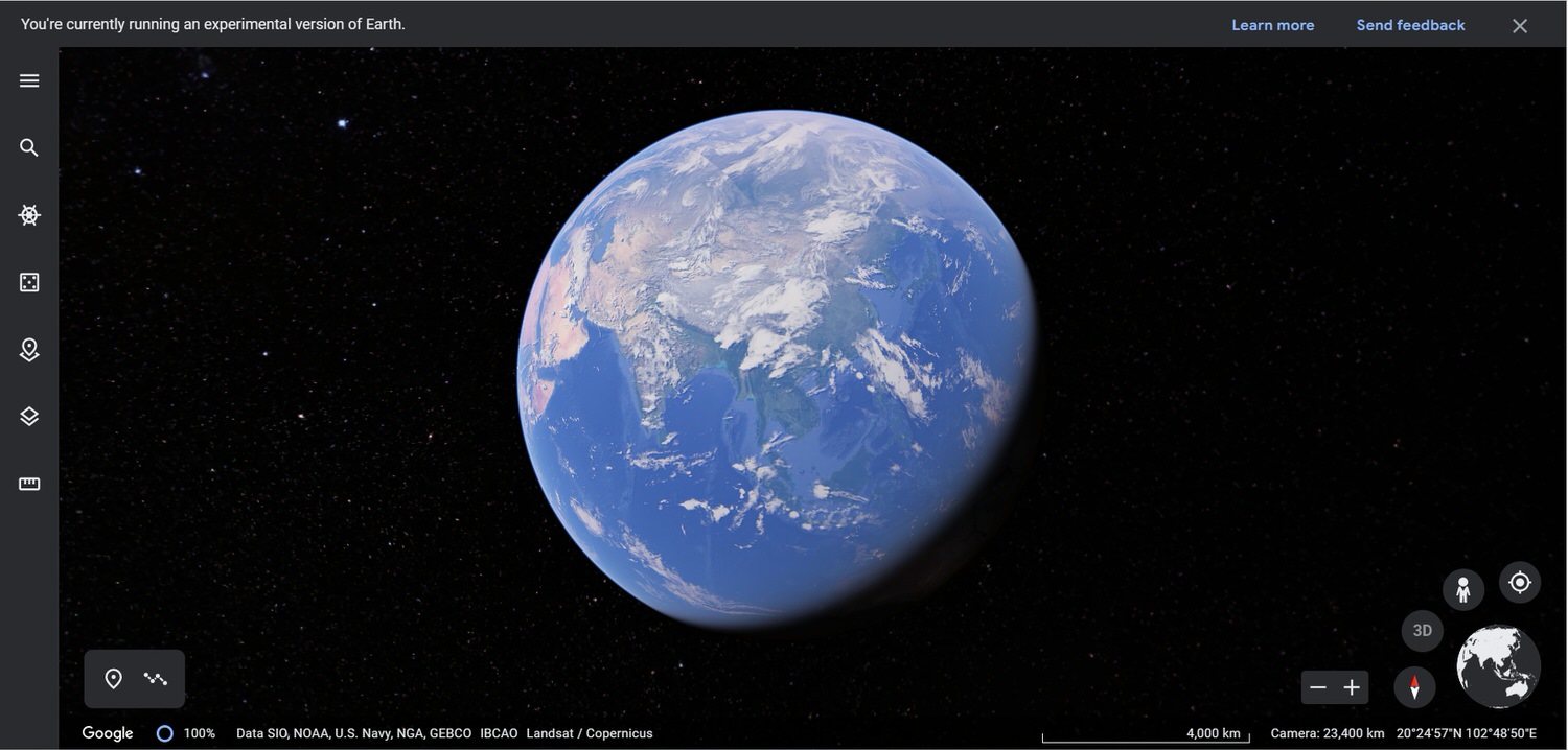
選擇網頁版之後便會進入以下畫面,點選左上至下的第五個匯入KMZ資料。
After selecting the web version, user will enter the following screen, look at the upper left to the bottom and click the fifth button to import KMZ data from the happyman.
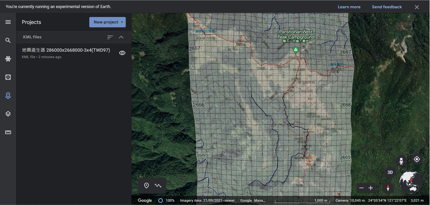
匯入后便會這樣,這時候產生時的透明度應該都會影響。
It will be like this after importing, and the transparency should be affected when it is generated at this time.
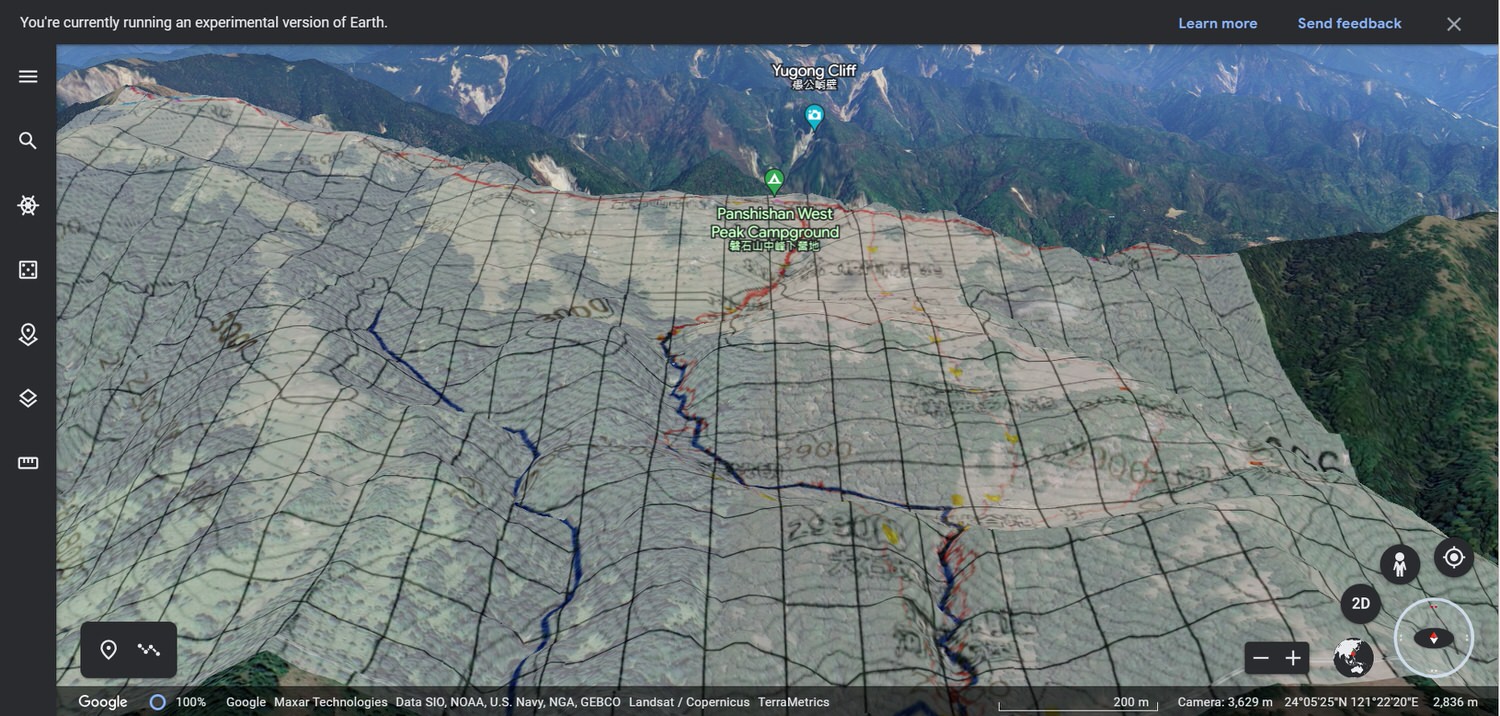
按右下角的地球,便會更換成個人使用模式,方便又好用,再來就可以操控成這樣看地圖。
Press the earth in the lower right corner to switch to personal use, which is convenient and easy to use, and then user can control it to look at the map like this.
05-2 谷歌地球電腦版 Google Earth PRO PC Version
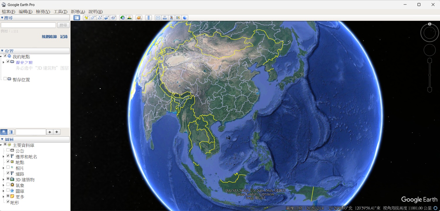
選擇電腦版之後便會進入以下畫面,點選左上角的檔案(F) 便可以看到有欄位可以匯入KMZ資料。
After selecting the pc version, user will enter the following screen, look at the upper left import(匯入) button to import KMZ data from the happyman.
匯入后便會這樣,這時候產生時的透明度應該都會影響。
It will be like this after importing, and the transparency should be affected when it is generated at this time.
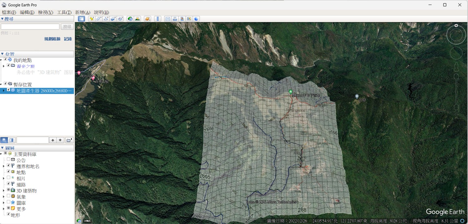
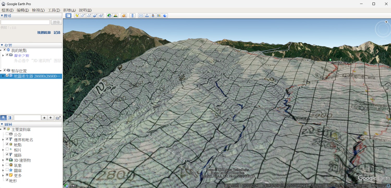
按右上角的地球,便會更換成個人使用模式,方便又好用,再來就可以操控成這樣看地圖。
Press the earth in the upper right corner to switch to personal use, which is convenient and easy to use, and then user can control it to look at the map like this.
06 總結
地圖產生器是個很好用的平台與工具,若可以學會如何好好利用,這在各種的行程上都是很大的助力,使用電子地圖的同時還保留著紙本地圖,讓自己更安全一些。
The happyman map generator is a very useful platform and tool. If you can learn how to use it well, it will be of great help in various itineraries. While using the electronic map, you can also keep the paper map to make yourself safer.
如何用地圖產生器製作地圖的文章很多人寫過了,不過有英文翻譯的卻沒有,特此寫了這邊給國際朋友。有什麽問題,或是文章哪邊可以補充,歡迎留言給我,也可以到我的IG密我,謝謝!
Many people have written articles on how to use the map generator to make maps, but there is no English translation, so I write it here for international friends. If there any questions, or where you can add to the article, please leave a message to me, or text me on my IG, thank you!
*本篇非商業合作文章
* Non-commercial purpose article

花了很久的時間撰寫這篇文章,希望大家會喜歡。
It took a long time to write this article, I hope you will like it.
別忘了繼續鎖定我的部落格和社群平臺,按讚/訂閲/追蹤並分享,給與我一些支持吧!
Don’t forget to continue to follow my blog and social platforms, LIKE/SUBSCRIBE/FOLLOW and SHARE, give me some support!
主 | 跟戶外/旅游/美食/玩/一般生活歡迎關注【法蘭怎麽玩】:
Main | Outdoor/Travel/Food&Beverage/Play/Fun/Life 【How Frank Play】:
👉 法蘭怎麽玩 How Frank Play | 部落格 Blog
👉 法蘭怎麽玩 How Frank Play | 即時電報 Instagram
👉 法蘭怎麽玩 How Frank Play | 臉書 Facebook
👉 法蘭怎麽辦 How Frank Play | 優管頻道 Youtube Channel
次 | 更多關於隨意拍攝的記錄請關注【法蘭克隨機生活記錄】:
Minor | About Random Life Record 【Frank Random Life Record】:
👉 法蘭克 Frank | 部落格 Blog
👉 法蘭克 Frank | 即時電報 Instagram
👉 法蘭克 Frank | 臉書 Facebook
👉 法蘭克 Frank | 優管頻道 Youtube Channel